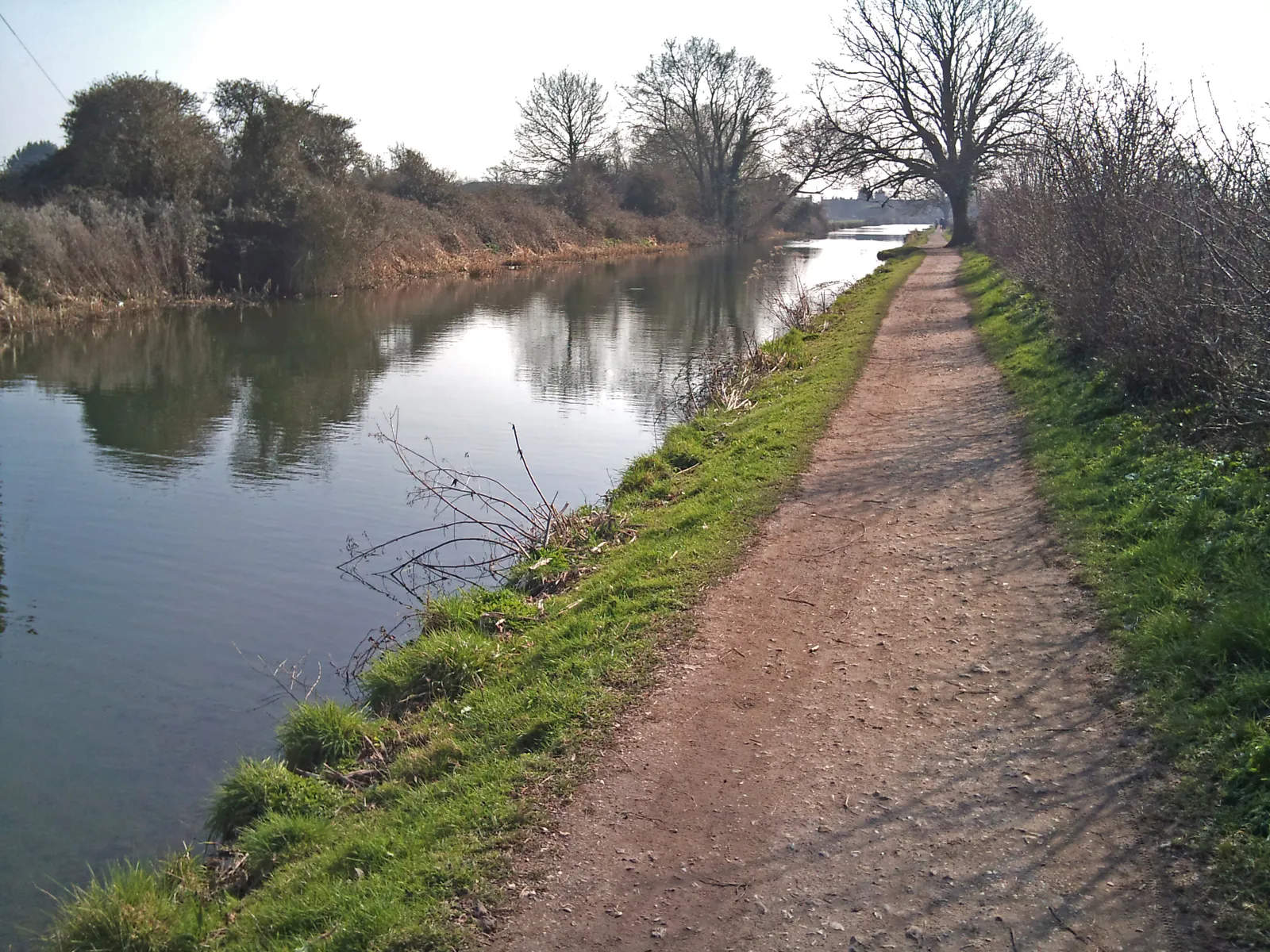

The canal towpath runs 4 miles to the harbour and Centurion Way 5.5. 12 walks near Chichester, with distances, tides, parking, dog rules and toilets checked.
The walks most people near Chichester start with are the city walls, a raised circuit of about 1.5 miles; the canal towpath to the harbour; Centurion Way, the old railway line to West Dean; and Kingley Vale, the yew forest on the Downs. Every entry was checked against the owner’s or managing body’s own pages on 26 October 2026.
We have not graded these routes and nothing here is a ranking. Each entry sets out what the path’s owner or manager publishes: the Chichester Walls Trust, the Chichester Ship Canal Trust, West Sussex County Council, the South Downs National Park Authority, Chichester Harbour Conservancy, Natural England, the RSPB and the West Wittering Estate. That means distance, time, surface, tides, dogs, buses, parking and toilets. Where a source did not say, we have not guessed.
This week. No trains run west of Chichester from Monday 26 to Friday 30 October, so Fishbourne and Bosham stations are closed; our travel page has the replacement buses.
The harbour walk guides are old. The Conservancy’s walk leaflets say they were tested in 2013 and warn that some paths may have been diverted and pubs renamed since. Bus details in them are out of date, so check buses on Traveline before you set out.
In and around the city
The city walls walk
The Roman walls still enclose most of the city centre, and the Chichester Walls Trust says the circuit “can be followed on foot for nearly 1.5 miles”, with a leaflet from the Tourist Information Centre, trail markers and information panels along the way. The walls as they stand date from the 3rd century and were 7 metres high; they are now a scheduled monument. The trust runs guided walks of about 90 minutes at 2pm on the first Sunday of the month from April to September, from the Tourist Information Centre at The Novium, Tower Street, PO19 1QH: £5 an adult, children free, no need to book. The circuit passes through Priory Park, where dogs are banned all year (our report on the rules).
Chichester Canal towpath, Canal Basin to Chichester Marina
The Chichester Ship Canal Trust calls the towpath “a gentle 4 mile walk” through open farmland from the Canal Basin, a few minutes from the bus and railway stations, to Chichester Marina at Birdham. Stop at Hunston Bridge for the view of the canal with the cathedral and the Downs behind, which the trust says JMW Turner painted in 1828. There is a cafe at each end: the Canal Cafe at the Basin and the Boathouse at the Marina. The trust asks for dogs on a lead at all times and kept out of the water. Parking is free at both ends, limited at the Basin. To walk one way, the trust gives the 51 from Hunston and the 52 or 53 from the Marina back to the bus station.
Centurion Way, Chichester to West Dean
A walking and cycling path on the bed of the Chichester to Midhurst railway. West Sussex County Council gives it as 5.5 miles (9km) from near Bishop Luffa School to West Dean, by way of Lavant, while the National Park’s project page gives 11km. It is tarmac to north of Lavant and compacted stone beyond, mostly flat. At West Dean there are steps with a cycle ramp the council says suits most wheelchairs and pushchairs. The 60 bus runs between the two ends. The National Park is extending the path north towards Cocking in stages, with a section due to reach Littlewood by the end of October 2026. It says parking near the route is very limited.
Chichester to Bosham, through Fishbourne Meadows
Chichester Harbour Conservancy’s Walk 11 is 7km, about 4 miles and two hours, from the cathedral on West Street to Bosham. It heads out through Westgate and an underpass beneath the A27 into Fishbourne Meadows, where the Conservancy says cows often graze and dogs should be on a lead, then past the Mill Pond, through a reedbed and along the Fishbourne Channel. The reedbed path floods when the tide is 4.8m or higher, and the stretch inland from the channel “can be quite boggy”. Toilets are in Tower Street, opposite the cathedral, and in Bosham car park. The guide links on to its Across the Harbour walk for a longer day.
Chichester Harbour and the coast
Bosham village loop
The Conservancy’s easier access route is a 2km circuit from the village car park past the shops of Bosham Walk, the church and the quay, then along the shoreline road and the raised path called The Trippett. It is fairly flat and, the Conservancy says, suitable for wheelchairs and mobility scooters, though the shoreline road is “not passable at high tide” and can be covered in seaweed in summer. Quay Meadow, by the church, belongs to the National Trust. The car park is pay and display, with an accessible toilet; the guide notes that none of the cafes and pubs on the route has an accessible toilet, apart from the Millstream Hotel, which serves non-residents at lunch and dinner only.
Chichester Marina to Dell Quay
The Conservancy’s Walk 3 is a 7.5km (4½ mile), two-hour figure of eight from the free visitors’ car park at Chichester Marina, Birdham. It passes a reedbed with a bird hide, follows the shore through Salterns Copse, an eight-acre wood, to Dell Quay, which the Conservancy describes as once a busy commercial port, and returns on farm tracks that are part of the Salterns Way cycle route, crossing the marina lock on the way back. The Conservancy says the paths are non-tidal, which makes this one of the few harbour walks that does not need a tide table. Toilets are near the entrance to Salterns Copse, with cafes at the marina and the Crown and Anchor at Dell Quay.
West Wittering beach and East Head
The Conservancy’s Walk 6 is a 6km (4 mile) loop of about an hour and a half along the sand at West Wittering and around East Head, the National Trust’s sand dune spit, then back past the old coastguard cottages and the church. It starts at the Old House at Home pub in Rookwood Road, PO20 8AD, or the beach car park. East Head is on tidal sands; at 4.6m and above, walk through the dunes instead. The West Wittering Estate opens its car park all year, 7am to 6pm in winter, and charges by the day or evening, not by the hour. From 1 May to mid-September dogs are kept off the bathing zone in front of the beach huts; from mid-September to April they are welcome everywhere.
Pagham Harbour, Sidlesham
The RSPB runs this nature reserve of saltmarsh, mudflats, lagoons and shingle beach on the Selsey road. From the visitor centre (PO20 7NE), the Discovery Trail is 1.75 miles, about an hour, with a 20-minute pushchair-friendly section; a shorter 0.75-mile loop on a level path is listed as wheelchair friendly, though the RSPB warns its trails can be muddy and waterlogged. The Church Norton trail is 800m. Parking is £2 up to four hours and £3 over, free for RSPB and Sussex Wildlife Trust members and Blue Badge holders. Toilets open 9am to 5pm. Dogs under close control are allowed on the public paths, but not on the Discovery Trail.
The Downs and the north of the district
Kingley Vale National Nature Reserve, West Stoke
Natural England says the reserve has “one of the finest yew forests in western Europe”, with a grove of veteran yews, some over 500 years old, and 14 scheduled ancient monuments; it was one of the country’s first National Nature Reserves, in 1952. Cattle or sheep graze it year-round, so dogs must be on a lead at all times. Some paths are steep and uneven, and there may be unexploded ordnance from former military use: do not touch metal objects. There is no bus. The small West Stoke car park, off Downs Road from Mid Lavant, takes vehicles under 2m high and fills at weekends and in school holidays; Forestry England’s car park at Stoughton, to the north, is quieter. No public toilets are listed.
Levin Down, from Singleton
The National Park’s Levin Down walk is a moderate 2 to 3 miles, one to two hours, from Singleton village up onto a hillside nature reserve of grassland, scrub and rare chalk heath. The name, the National Park says, comes from “Leave-Alone Hill”, land too steep for the plough. The reserve is grazed, so dogs go on a lead, and the National Park lists views of the Trundle and Goodwood racecourse to the south. In Singleton it lists the Partridge Inn and a tearoom, and the Weald and Downland Living Museum is just outside the village. For a full day, its Singleton and the wooded estates walk is 6 to 7 miles, three to four hours.
Midhurst river walk
An easy 2 to 3 mile walk of one to two hours, set out by the National Park, from opposite the main bus stop in Midhurst down North Street, past the National Park’s visitor centre, and out along the River Rother on a permissive path and a raised boardwalk over wetland. It enters the National Trust’s Woolbeding parkland, passes a folly and goes through Whiphill Wood before coming back by June Lane near the Half Moon pub. There are gates and kissing gates. The National Park suggests looking out for kingfishers and, in summer, banded demoiselles by the river. Its short walk around historic Midhurst covers the town itself.
Iping and Stedham Commons
A 1 to 2 mile Miles Without Stiles route of half an hour to an hour on lowland heath, a nature reserve run by the Sussex Wildlife Trust west of Midhurst. The National Park says it suits wheelchairs, mobility scooters and pushchairs: a sandy surface, uneven in parts but mostly level, with some slight gradients. It follows the Serpent Trail past two heather-covered Bronze Age burial mounds. Start from the Iping Common car park, GU29 0PB; the 91 and 92 buses stop opposite Iping Lane. The nearest public toilets are in Midhurst. Across the road on Stedham Common, the Dragonflies Rest sculpture is one of seven on the Heathland Sculpture Trail.
How we chose
These are the walks people near Chichester search for, chosen from what the path owners and managers publish, not on taste. We started with the city walls, the canal and Centurion Way, then took Chichester Harbour Conservancy’s walk guides, the South Downs National Park’s routes, Natural England’s reserve page and the RSPB’s. We left out routes we could not check on an owner’s page: the National Trust’s walk pages for East Head, Slindon and Petworth Park would not load for us. Distances and times are the publishers’ own and vary between sources, as with Centurion Way. Everything was checked on 26 October 2026.
Run a place that should be here, or spot something that has changed? Email newsdesk@chichesterlive.co.uk.
For somewhere to eat or drink after a walk, see our guides to Chichester pubs, Sunday roasts, Chichester cafes and Chichester restaurants. With children, see Chichester playgrounds. For more ideas, see things to do in Chichester, what’s on in Chichester this month and parking in Chichester, or browse the pubs and cafes in our Chichester business directory.
Frequently asked questions
Which walks near Chichester are suitable for wheelchairs and pushchairs?
Chichester Harbour Conservancy’s Bosham easier access route is a fairly flat 2km circuit it lists as suitable for wheelchairs and mobility scooters. The South Downs National Park’s Iping and Stedham Commons walk is a 1 to 2 mile Miles Without Stiles route on a mostly level sandy surface. The RSPB’s shorter loop at Pagham Harbour is 0.75 miles on a level path, and Centurion Way is tarmac from Chichester to north of Lavant.
Can I walk my dog at Kingley Vale?
Yes, but Natural England says dogs must be on a lead at all times, because cattle or sheep graze the reserve year-round. The canal trust asks for dogs on a lead on the Chichester Canal towpath too, and dogs are banned from Priory Park, on the city walls walk, all year.
Do tides affect walks around Chichester Harbour?
Yes. The Conservancy says the reedbed path on its Chichester to Bosham walk floods when the tide is 4.8m or higher, the shoreline road on the Bosham loop is not passable at high tide, and East Head is on tidal sands, with a route through the dunes when the tide is 4.6m or more. Its Marina to Dell Quay walk is non-tidal.
Have your say